Japanese Archaeology and Special Exhibition (Heiseikan) Thematic Exhibition Room
October 14, 2015 (Wed) - December 23, 2015 (Wed)
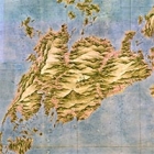
Born near Kujukurihama in present-day Chiba prefecture, Ino Tadataka (1745–1818) was adopted into a merchant family in Sawara. He enjoyed studying astronomy, geography, and mathematics while striving to manage the family business. After retiring at the age of fifty, he went to Edo (now Tokyo) and began a serious study of astronomy and surveying under Takahashi Yoshitoki at the government’s office of astronomy. Endeavoring to determine the exact length of one degree of the earth's latitude, Tadataka surveyed the land of Ezo (now Hokkaido) in 1800 almost entirely on his own. His survey and the resulting map attracted the attention of the government, which employed his to survey the entirety of Japan – an endeavor he dedicated the remainder of his life to. In 1821, after Tadataka's death, The Great Map of Japan, which was the culmination of his efforts, was submitted to the government.
Tadataka's maps are categorized as “large,” “medium,” or “small,” depending on their respective scales. Although the map submitted to the government was lost in a fire during the Meiji era (1868–1912), other fine maps of Japan in different scales, which were created by Tadataka and his associates at various times, are in the collection of the Tokyo National Museum and may be viewed and compared. In addition to superb examples of Tadataka's work, this exhibition will also feature maps of Hokkaido by Imai Hachikuro and a world map. A movie about Tadataka's maps is also being shown at the TNM & TOPPAN Museum Theater in connection with this exhibition.