Historical Records
-
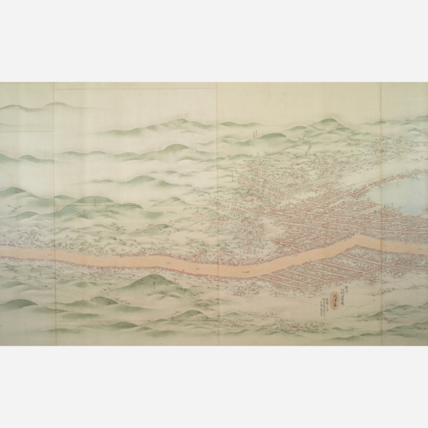
Maps of the Tōkaidō Road, Ōtsu: Ishiyama, Shikatobi, Miidera Temple, and Mount Hiei; Kyoto (detail)
Compiled by the Office of Road Management, Formerly owned by the Asakusa Bunko Library, Edo period, 1806 (Important Cultural Property)Japanese Gallery (Honkan) Room 15
February 25, 2026 (Wed) - April 5, 2026 (Sun)Tokyo National Museum has more than artworks and archeological artifacts. The collection also includes records, which provide valuable insights into history and the cultures of different ethnic groups. This diversity stems from the Museum’s origins as a comprehensive institution in 1872. It was even home to animal, plant, and mineral specimens, although these were moved to the National Museum of Nature and Science in 1925.
The extensive collection of historical records at Tokyo National Museum now includes maps, diagrams, texts, photographs, ink rubbings, and copies of artworks. These items, dating mainly from the 17th to 20th century, shed light on politics, society, culture, transportation, and scenery in Japan. Here we display a selection of these items under different themes throughout the year.
| Designation | Name | Creation/ Excavation/ Provenance |
Period | Acquisition/ Ownership/ Accession Number |
CMT | ||
| Highlight | Important Cultural Property | Map of Kyūshū's Coastline (1:36,000), No. 12: Makurazaki and Kushikino | By Inō Tadataka (1745–1818) | Edo period, 19th century | P-584-12 | ||
| Highlight | Important Cultural Property | Map of Kyūshū's Coastline (1:36,000), No. 13: Sendai and Akune | By Inō Tadataka (1745–1818) | Edo period, 19th century | P-584-13 | ||
| Volume 1 of The Museum's Illustrations of Fish | Compiled by the Museum Bureau; illustrated by Kurimoto Tanshū and others | Edo period–Meiji era, 19th century | QA-863-1 | ||||
| Volume 2 of The Museum's Illustrations of Fish | Compiled by the Museum Bureau; illustrated by Kurimoto Tanshū and others | Edo period–Meiji era, 19th century | QA-863-2 | ||||
| Highlight | Important Cultural Property | Maps of the Tōkaidō Road, Ishibe: Iwane Yakushi Temple, Mount Minomatsu, Saiji Temple, and Toji Temple; Kusatsu: Yamada and Yabase; Ōtsu: Ishiyama, Shikatobi, Miidera Temple, and Mount Hiei; Kyoto | Compiled by the Office of Road Management, Formerly owned by the Asakusa Bunko Library | Edo period, 1806 | P-582-11 |